ONLYgeotechnics has expertise in reclamations and ground treatment developed over many years with one of the first projects when the Company started in 2006 being the massive port development in London Gateway. The first reclamation project was in Egypt. In Hong Kong the Company has been involved in many of the recent major reclamations. Of particular note is the current expansion of Hong Kong International Airport involving the formation of over 650Ha of new land over deep soft marine deposits using primarily deep cement mixing, PVDs and surcharging. ONLYgeotechnics was involved from 2012, initially as Peer Reviewer and subsequently as Independent Checking Engineer for the reclamation. Current work includes providing ad-hoc expertise on a range of topics from ground treatment to geophysics. During the Peer Review, specialist research was carried out with HKUST to examine the behaviour of the DCM in detail.
ONLYgeotechnics has been involved in most aspects of reclamation in Hong Kong including: ground investigations; settlement predictions and construction monitoring; ground treatment assessments, including stone columns; slope stability at the design stage and during construction, including seismic; settlement assessments at design and construction stages, including understanding the cause of excessive displacements; assessing time settlement data to examine the degree of consolidation and examining ‘locked-in’ excess pore water pressures tied to rapid construction and the impact on secondary compression. ONLYgeotechnics has also been closely involved with specialists providing geophysics advice and design.
Third Runway System (3RS)
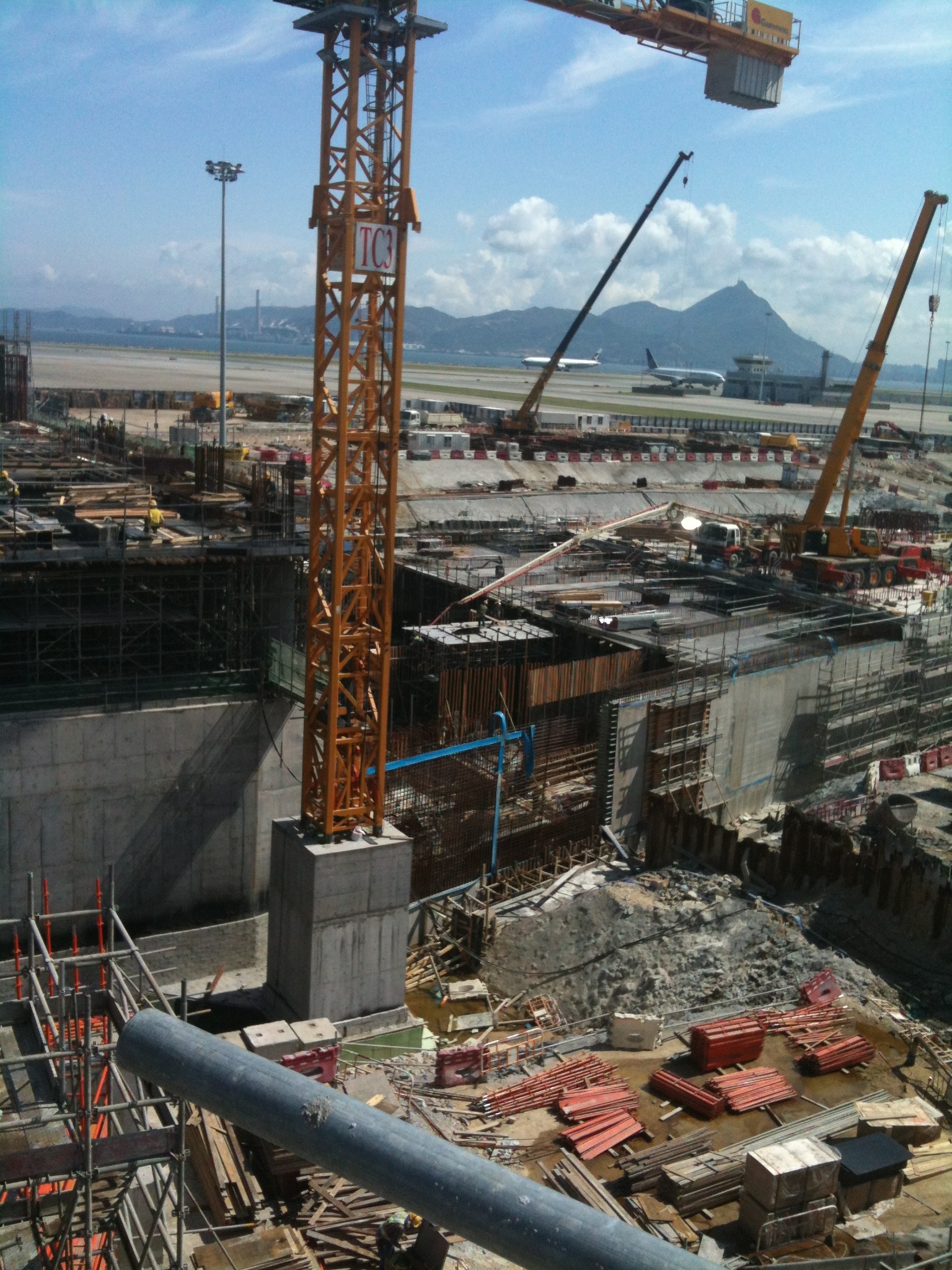
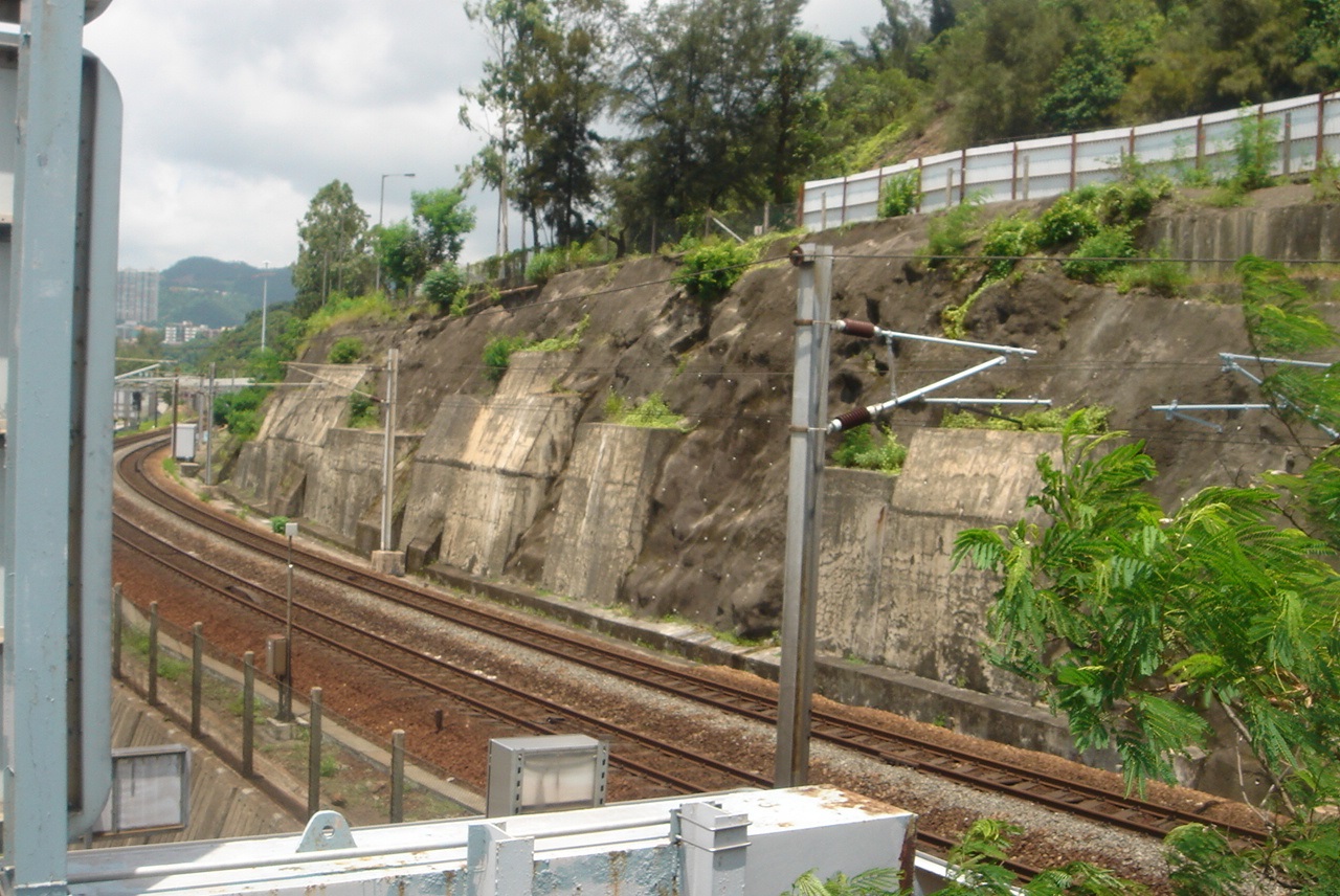
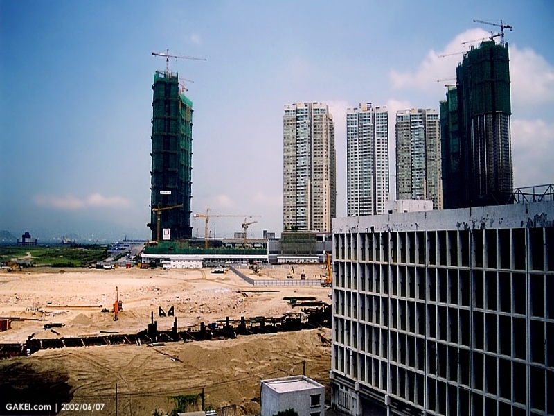
Hong Kong’s exceptional demand as an airport hub for both passengers and cargo has led to the capacity of the existing airport facility being exceeded. The island of Chek Lap Kok, immediately north of Tung Chung in Lantau on which the airport sits, was created in the 1990s to replace the restricted environment around Kai Tak Airport in Kowloon. HKIA was created by substantially dredging the deep soft marine clays between existing islands off Lantau and blasting the granite islands to create a platform of 1250Ha at a level of around +6mPD.
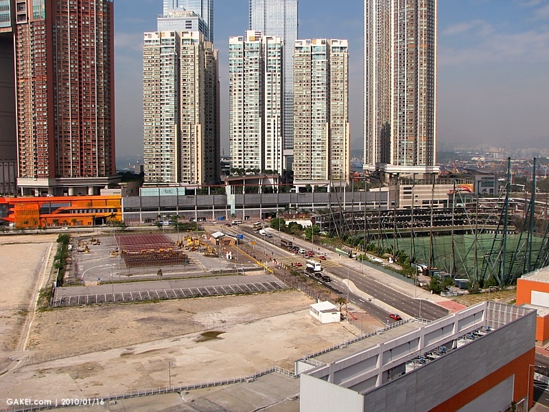
The Airport Masterplan gave early attention to the need to extend the airport and detailed studies arrived at the option of extending the existing airport into the sea to the north of Chek Lap Kok by filling over the very soft clay to create new land about 650Ha in area. The land would be used both for a new northern runway as well as essential infrastructure such as a new terminal building, road and rail access.
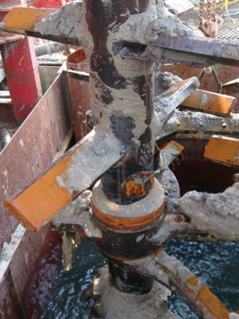
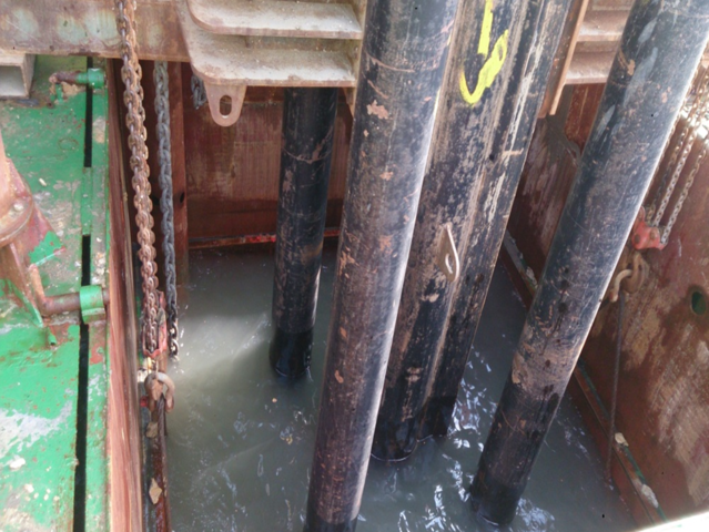
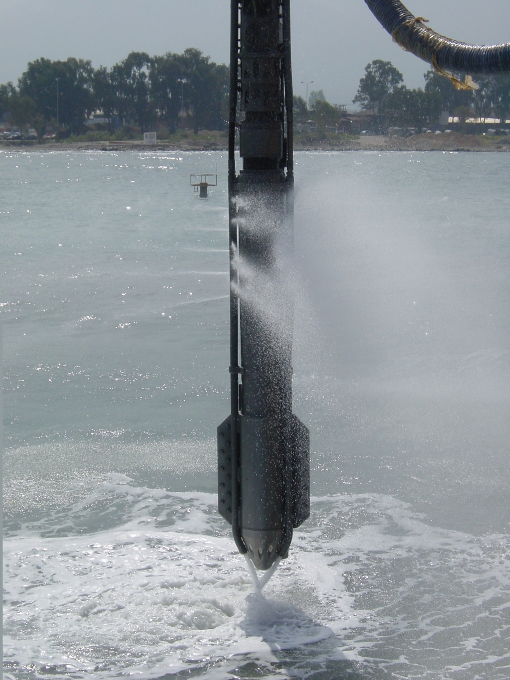
Detailed studies have led to the formation of the new land using deep cement mixing (DCM) as the main method of confining the new fill over the soft mud. This approach has environmental and programme advantages over traditional methods of remove/replace and is consistent with Government guidelines which aim to minimize future dredging in Hong Kong. Shortage of reclamation sand was one of the considerations in reviewing a non-dredged option. The airport filling is in phases to meet the tight project programme with handovers rapidly following completion of the platform. Areas not using the DCM method of stabilization are subject to PVDs and surcharging and there is extensive instrument monitoring required to satisfy the very stringent ICAO standards on differential settlement for Airports.
Midfield Concourse
Prior to commencement of the Third Runway scheme and to extend the existing airport, passenger demand required an interim solution to deal with the very high passenger traffic. This was fulfilled in the 2010s by constructing a major new terminal within the midfield area of the airport (between the north and south runways). This major construction required an extensive area of land to be excavated and dewatered for the foundations of the new building which were founded below sea-level. The dewatering was a challenging part of the project due to the nature of the fills used in the site formation which varied from very large boulders (2 metres) to fine sands and silts.
Hong Kong Boundary Crossing Facilities
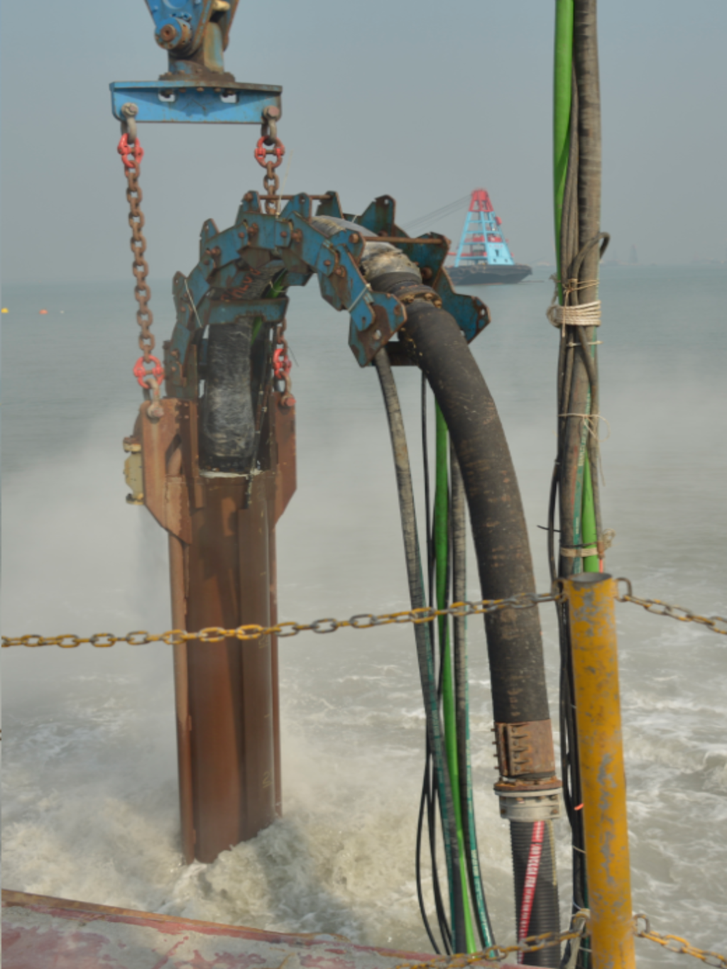
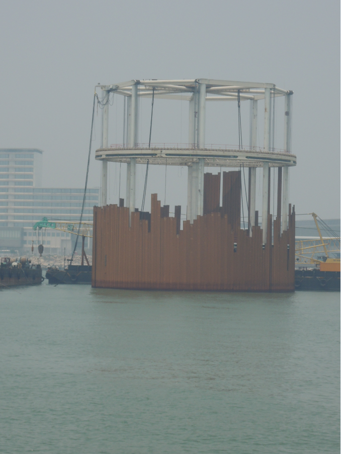
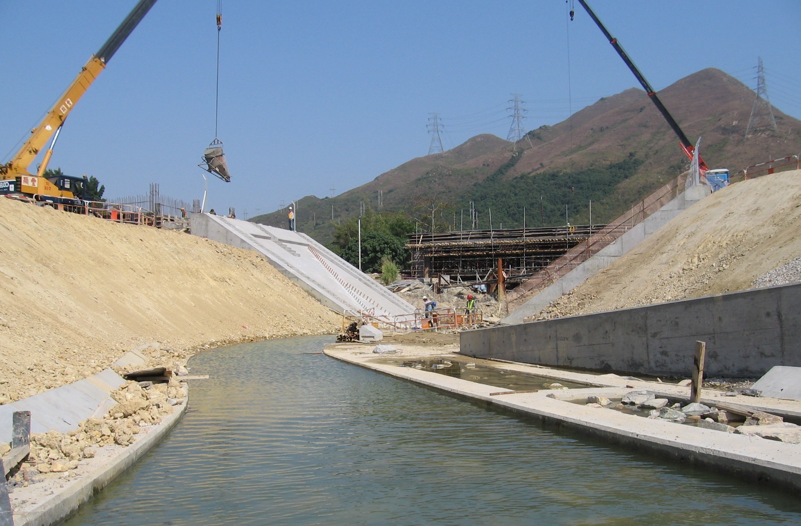
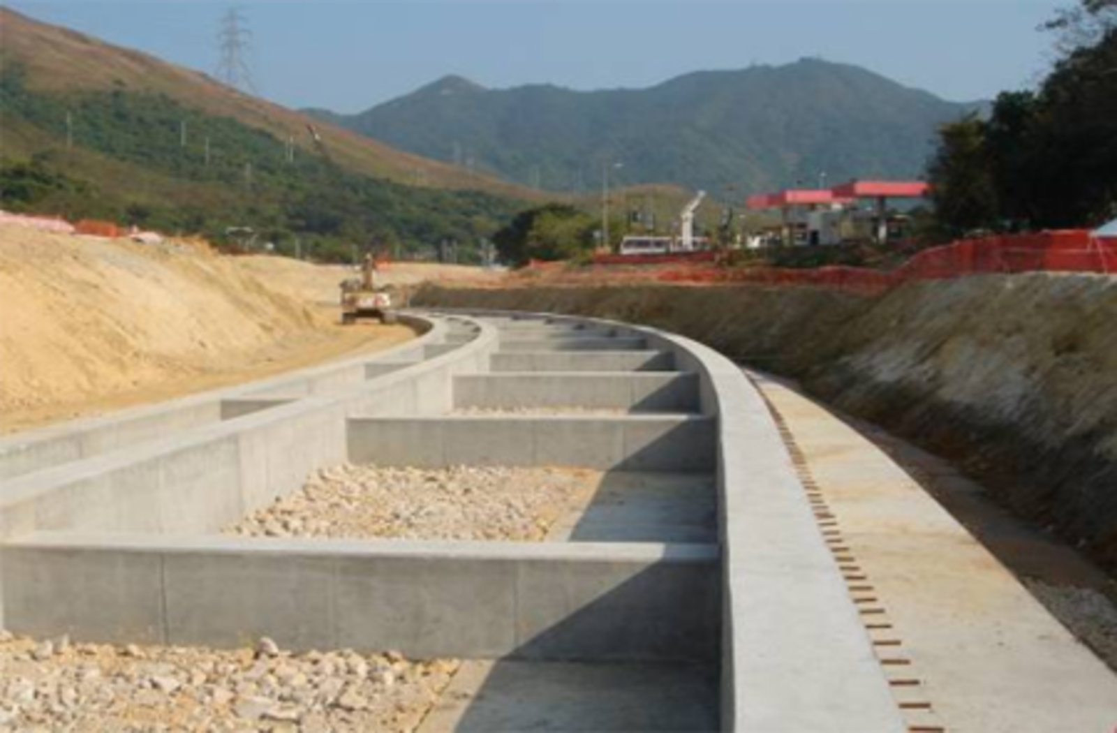
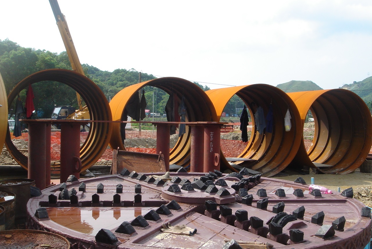
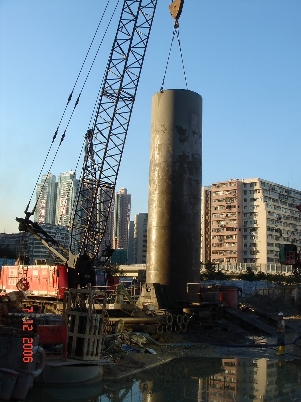
Stone columns within 31.2m diameter steel cells form the outer confining walls to construct the new 150ha artificial island connecting with the northeast corner of Chek Lap Kok (Hong Kong International Airport) platform and eventually to the Hong Kong-Zhuhai-Macau Bridge. PVDs and surcharging provide ground improvement in the main body of the reclamation. The project involved extensive monitoring and a fast track programme to complete the reclamation as part of the Hong Kong-Zhuhai- Macau Bridge Scheme. Innovative techniques were used during construction including the adoption of the observational method with PVDs and surcharging to replace some sections of the stone column/steel cell design in a zone closest to the existing airport land.
Hong Kong Link Road Scenic Hill To HKBCF
Hong Kong Link Road is a major highway linking the Hong Kong Boundary Crossing Facilities (HKBCF), immediately east of Hong Kong International Airport, to the Hong Kong-Zhuhai-Macau Bridge, at the south-west corner of the airport island. Contract HY/2011/03 is the eastern end of the Link Road and comprises a tunnel through Scenic Hill and an at-grade road onto the south-west corner of HKBCF. The at-grade section of the Link Road requires a tunnel beneath the existing airport express highway and reclamation of about 23 Ha along the east coast of HKIA. The at-grade road is approximately 1.6 km long. The ground treatment comprised of a stone column foundation to the boundary seawall with PVD and surcharge in the main body of the reclamation.
Tseung Kwan O - Lam Tin Tunnel Road P2 And Associated Works
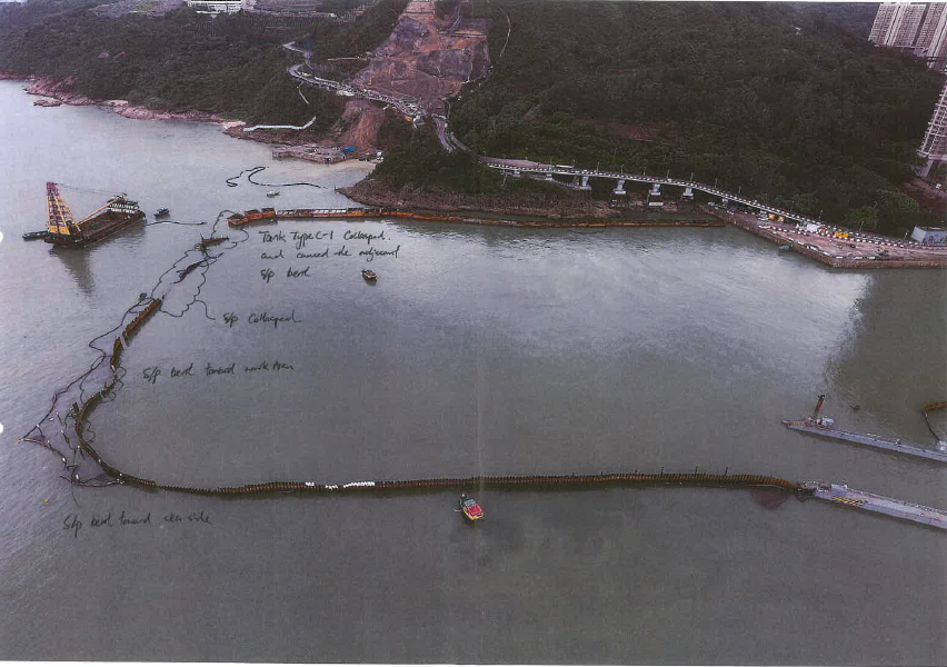
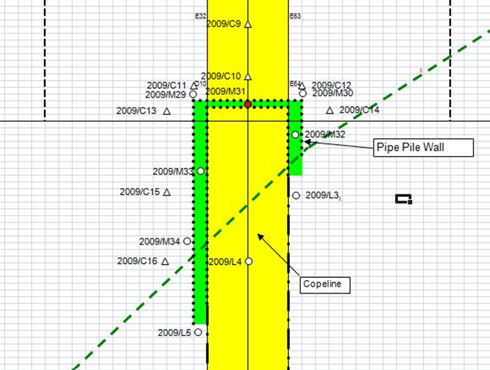
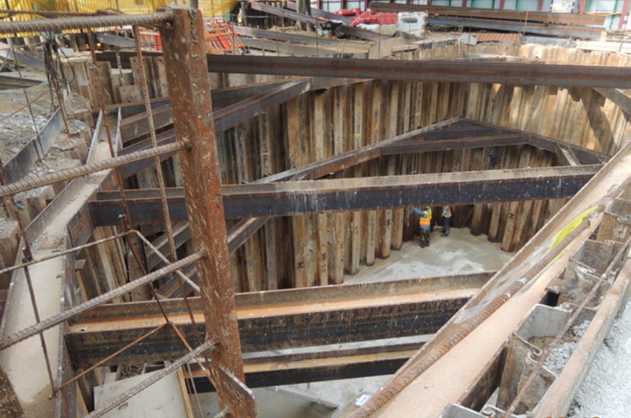
The Tseung Kwan O to Lam Tin (TKO-LT) Tunnel scheme is a 4.2km dual two-lane highway connecting Tseung Kwan O in the East to Trunk Road T2 at Kai Tak. The scheme is divided into three contracts. Contract NE/2015/02 is the construction contract for the eastern part of Road P2 and Associated Works and includes a 3-hectare reclamation at Junk Bay. The dual two-lane Road P2 under this contract is approximately 800m long with approximately 200m of the carriageway buried in the reclamation and covered by a landscape deck. A temporary steel cofferdam was installed prior to dredging and reclamation as one of several measures to minimise the impact of dredging and reclamation on the water quality and is specified in the Environmental Permit.
The reclamation was nearing completion when work was interrupted by typhoon “Merbok” on 12th June 2017 causing significant damage to the supporting sheet pile walls. Following extensive repair, an even more powerful typhoon occurred on 16th September 2018 (typhoon Manghut) which had winds with gust over 230km/hr. Wind and water damage throughout Hong Kong was extensive.
Slopes / Retaining Walls
The senior staff at ONLYgeotechnics have a long history of designing, assessing and undertaking research of slopes with examples in Hong Kong and overseas. The experience includes extensive back-analysis of failed slopes as well as traditional soil and rock slope design. There are also many examples from our overseas work including detailed seismic assessments and ranging from anchored piled walls in complex geology to assessing causes of failure in land and marine slope conditions.
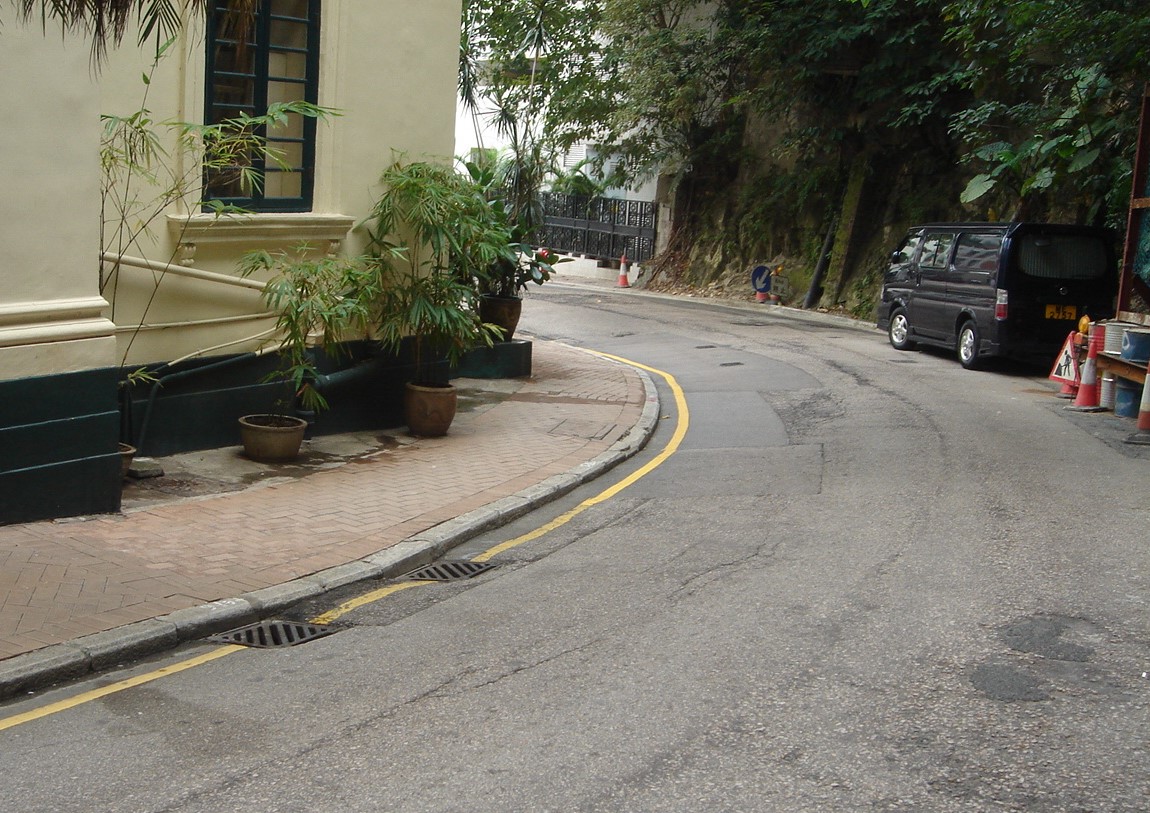
The First Church of Christ Scientist is an historical building on the Government Grade II register and sits adjacent to a busy road in mid-levels, Hong Kong. It is of stone construction and earlier investigations showed it to be founded on caissons and ring beams in the completely decomposed granite. The church sits between MacDonnell Road to the south and St. Paul’s Co-educational College to the north. The college was being extended with piling near the site boundary whilst repairs to a repeatedly distressed water pipeline in the main road using deep trenching were in progress. The church walls and floor had been subject to historical cracking which was continuing to widen and there was significant movement on the floor. The building had seen several past flooding events due to burst water mains in the main road and there was concern about the structural integrity of the church and its foundations.
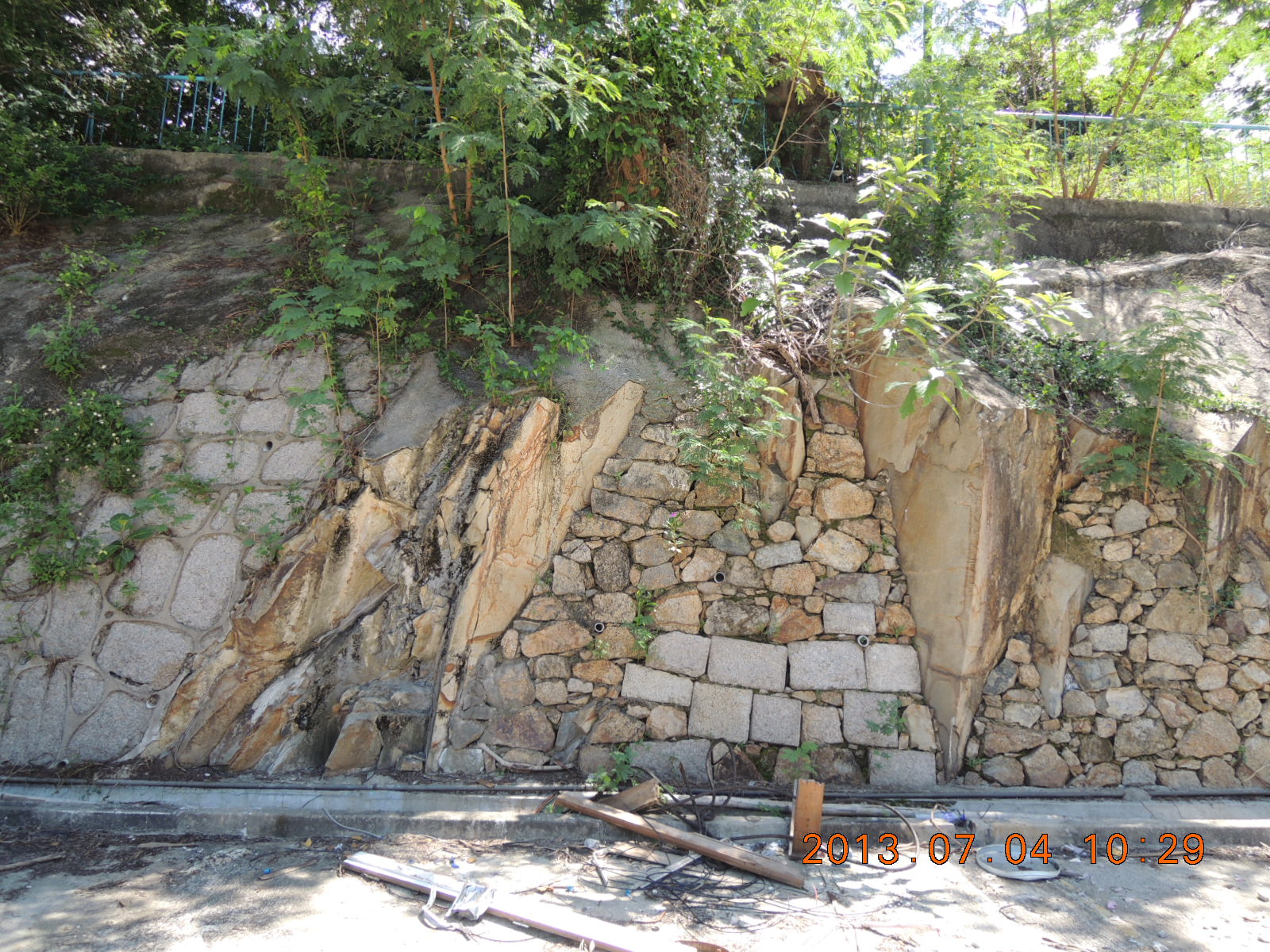
An existing development on Castle Peak Road in Tuen Mun was demolished to permit the construction of a new building. The site is bounded by rock slope Nos.6SW-C/C41 and 6SW-C/C42 on the northeast and southeast boundary. As part of the current development proposals, additional areas of rock slope will be created along with parts of the toe of the existing slopes – due to the formation of a vehicle access ramp. Investigation and design of the rock slopes was carried out including rock slope mapping and analysis by an experienced geologist.
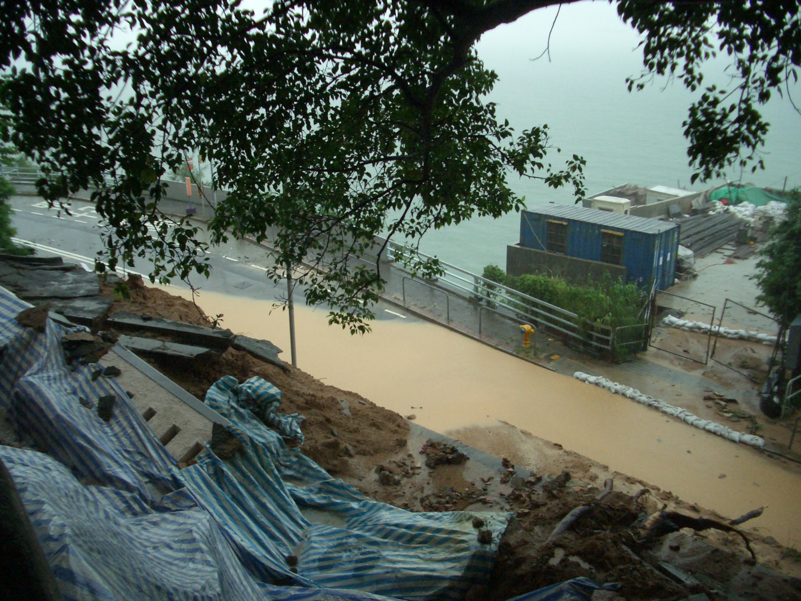
A slope failure occurred on the downhill side of the site due to a major summer storm. The slope failure resulted in the loss of a parapet at the slope crest (10m height) and the washing of debris onto Victoria Road, which lies at the toe of the failed slope. Significant wash-out and damage to an existing block-faced wall at the uphill entrance on Mount Davis Road also occurred. The site boundary was 100m long x 45m wide. The Buildings Department subsequently issued a Dangerous Slopes Order which required the owners to repair/upgrade the slope. Detailed investigations and analysis were undertaken highlighting the cause of the failure.
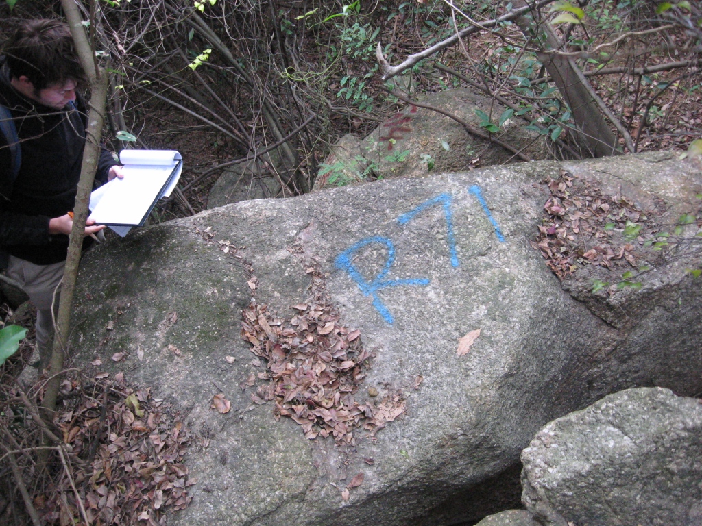
A boulder survey was carried out in the southern portion of Discovery Bay North Development Area N1e (Phase 14 Development), Discovery Bay, Lantau Island. The survey revealed that supporting structures were required on a series of boulders to prevent boulder falls. The proposed in-situ boulder stabilisation measures, using a supporting buttress, are a typical prescriptive measure to prevent boulder falls.
Anderson Road Quarry provided source rock for many construction sites for decades. In the past 20 years it has been firstly ‘made safe’ and subsequently re-configured with basic infrastructure and platform formation. The area remains under development for future public housing, government and public facilities. This part of the site is about 20 hectares and incorporates a major reinforced earth wall.
*Image obtained from GEO report.
Investigations were undertaken when a Reinforced Earth Wall on Tuen Mun Road widened – Tai Lam Section was subject to unexpected localized settlement during construction. The wall is adjacent to a piled section and is founded on relatively loose fill. Monitoring and site records indicate that movement was localized and occurred over a short period of time and that the majority of the wall did not move significantly.
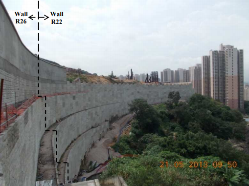
Retaining Wall RW-A119
The project includes the localised widening of Shui Chun Au Street which lies immediately south of the KCRC rail station at Shatin Wai. The existing road runs uphill towards the south and the works require the construction of a bus-bay at the toe of an existing hill to the west, to enhance the local facilities. The contract design provides for the construction of a piled retaining wall – RW-A119. The existing wall design incorporates the use of 508 diameter mini-piles in pairs for the whole of the wall length. The wall is approximately 160m long and lies at the foot of an existing formed cutting, at the top of which is village housing. Cost-effective alternatives required investigation to reduce the extent of piling thus also reducing disruption to the local community.
Tseung Kwan O landfill is one of the major landfill sites in Hong Kong. Following the restoration of the landfill around the year 2000, the site has been subject to regular monitoring and assessment to examine groundwater, settlement etc. The monitoring has included examination of cracking which developed along the line of a major drainage channel; geophysics techniques were used to investigate the possibility of voids close to the surface.
Tunnels / Railway / Highway
The Guangzhou-Shenzhen-Hong Kong Express Rail Link (XRL) project is the high-speed rail service between Hong Kong and Shenzhen connecting into the national high-speed passenger rail network in China leading to Beijing via Guangzhou. The Hong Kong section of XRL is approximately 26km in length running from Tsim Sha Tsui Terminal to the border at Shenzhen.
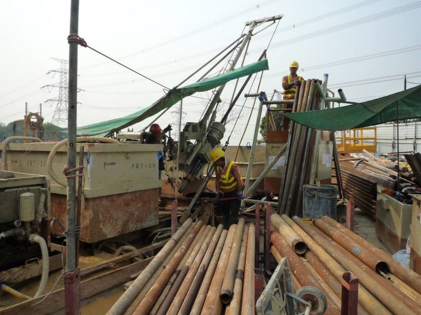
ONLYgeotechnics has been involved on XRL both at tender and construction stages on several of the major tunnel contracts. Work has included geotechnical studies and risk assessments, advice on tender submissions, interpretation of ground conditions, site supervision of specialised GI and forensic studies of water inflow at a cross passage.
ONLYgeotechnics has also carried out advisory work on West Rail involving a crossing below the existing live KCRC (now MTRC) near Sha Tin. This included innovative methods to deal with geotechnical risk associated with work adjacent to the live rail. ONLYgeotechnics supervised tunnel work during construction of a jacked tunnel below the live KCRC line in Fanling - part of the Drainage Services Department flood protection scheme where ONLYgeotechnics was the Independent Geotechnical Engineer providing site supervision and advice for 5 years. Tunnelling was controlled by observational methods with remote 24-hour automatic settlement readings on the live rail with appropriate Alert/Alarm/Action levels. ONLYgeotechnics has provided other specialist site expertise during tunnel construction, for example for the Lam Tin tunnel related to the quality of blasted rock where a senior person was on site for almost 2 years.
Other tunnel/rail work has included providing temporary works design over a 2 year period on site for Shatin to Central Link and advisory work related to tunnel leakage in Kai Tak.
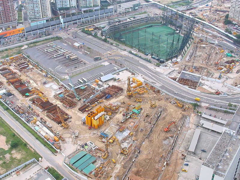
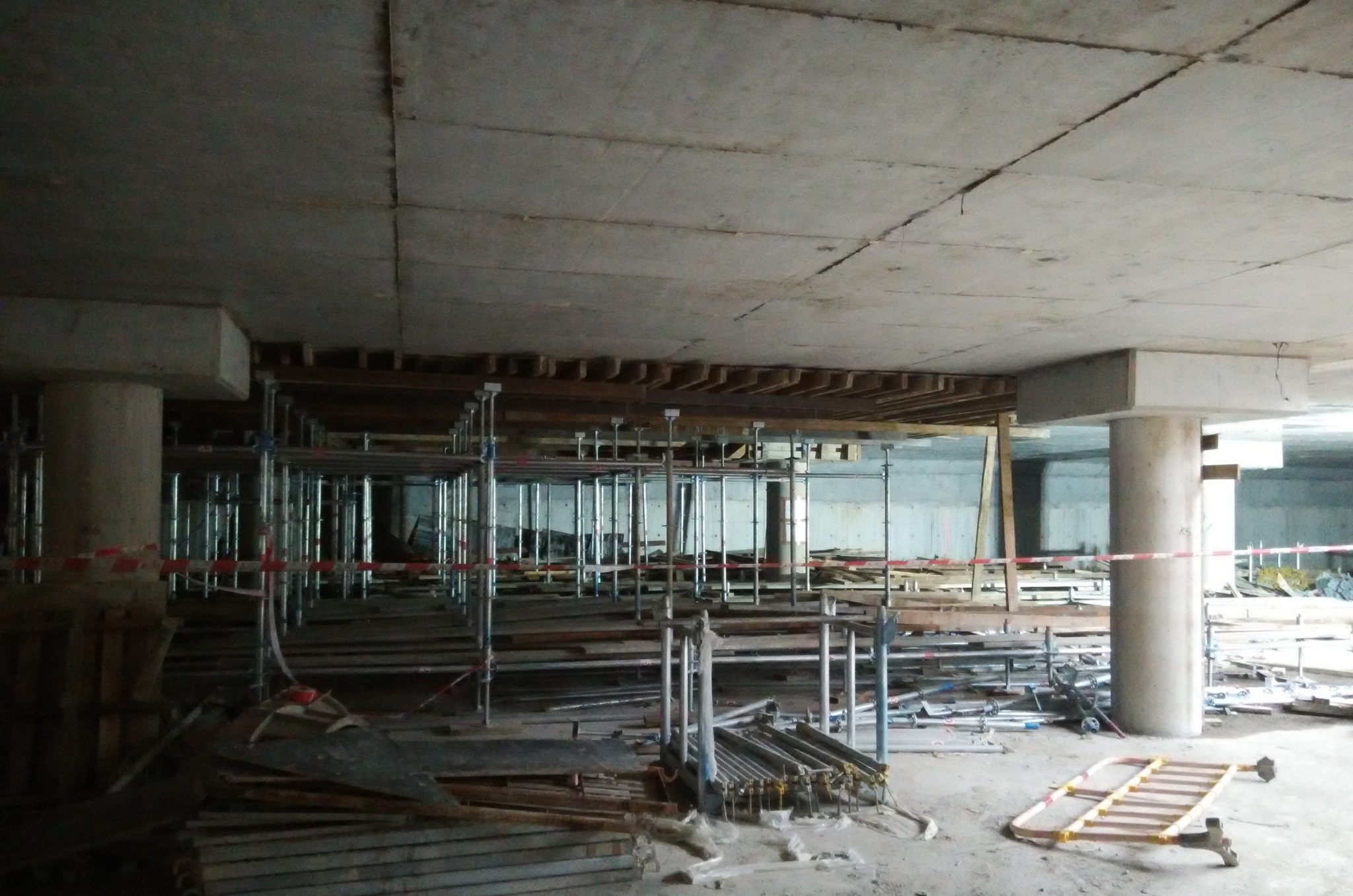
Contract 810 comprises the main excavation and initial construction of the Terminus in West Kowloon for the XRL project; Contract 811 comprises a major tunnel crossing immediately adjacent to the existing KDB300 West Rail MTRC tunnels to the north of the proposed terminus. Major risks included the design parameter, analysis, rock excavation and dewatering. The project required formation of a major open excavation with multi-level propping and excavation through existing reclamation and soft deposits into variable rockhead. This was all done under a tight construction programme with complex logistics working in a built-up area of the city.
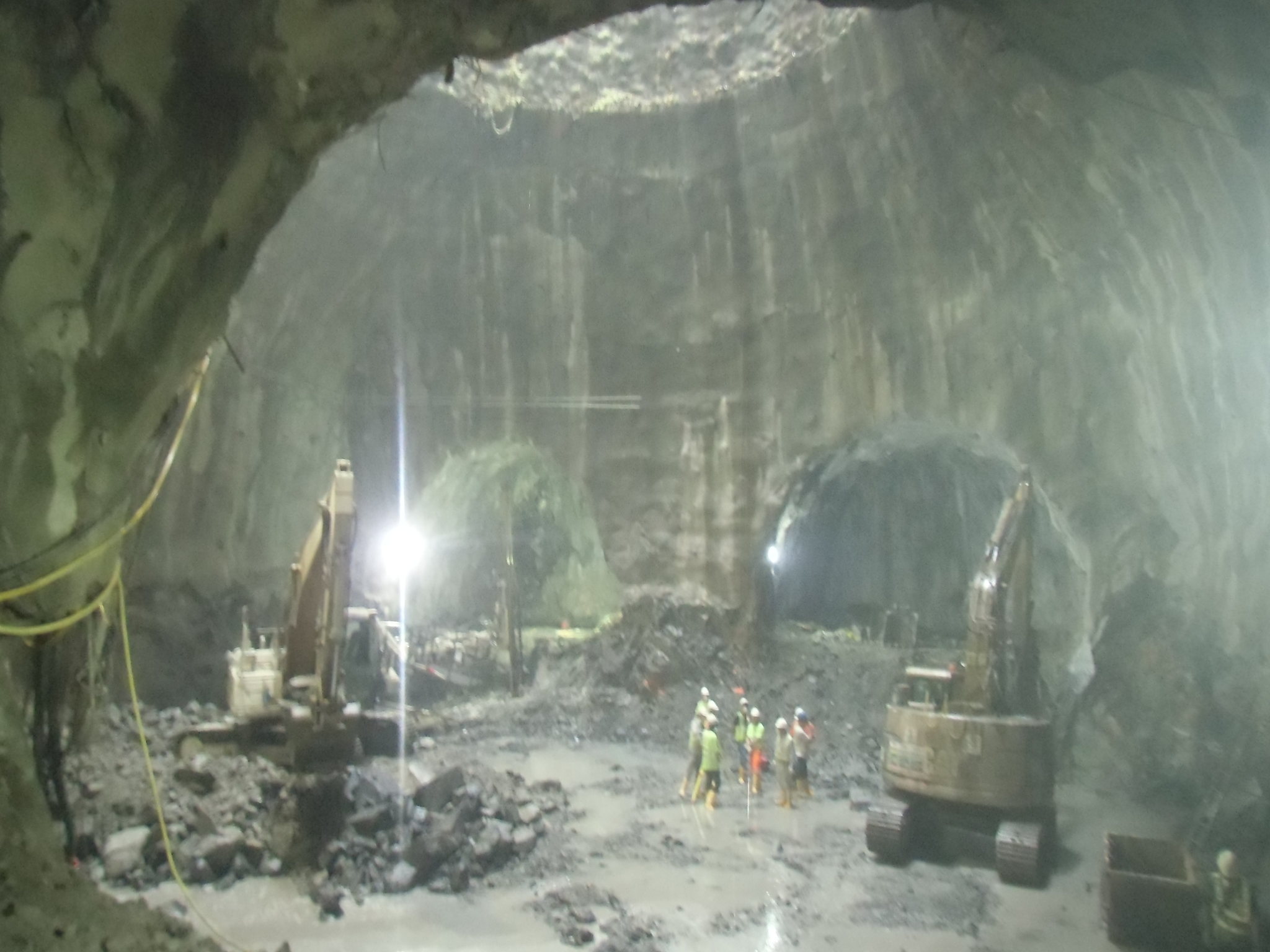
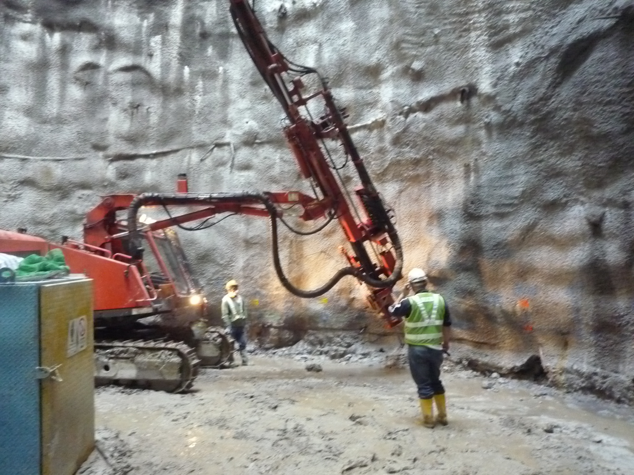
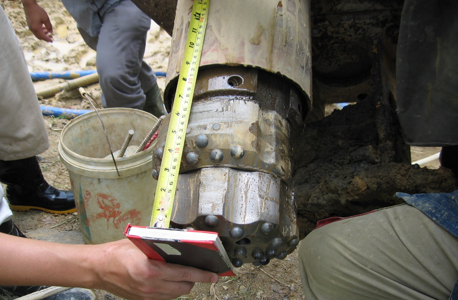
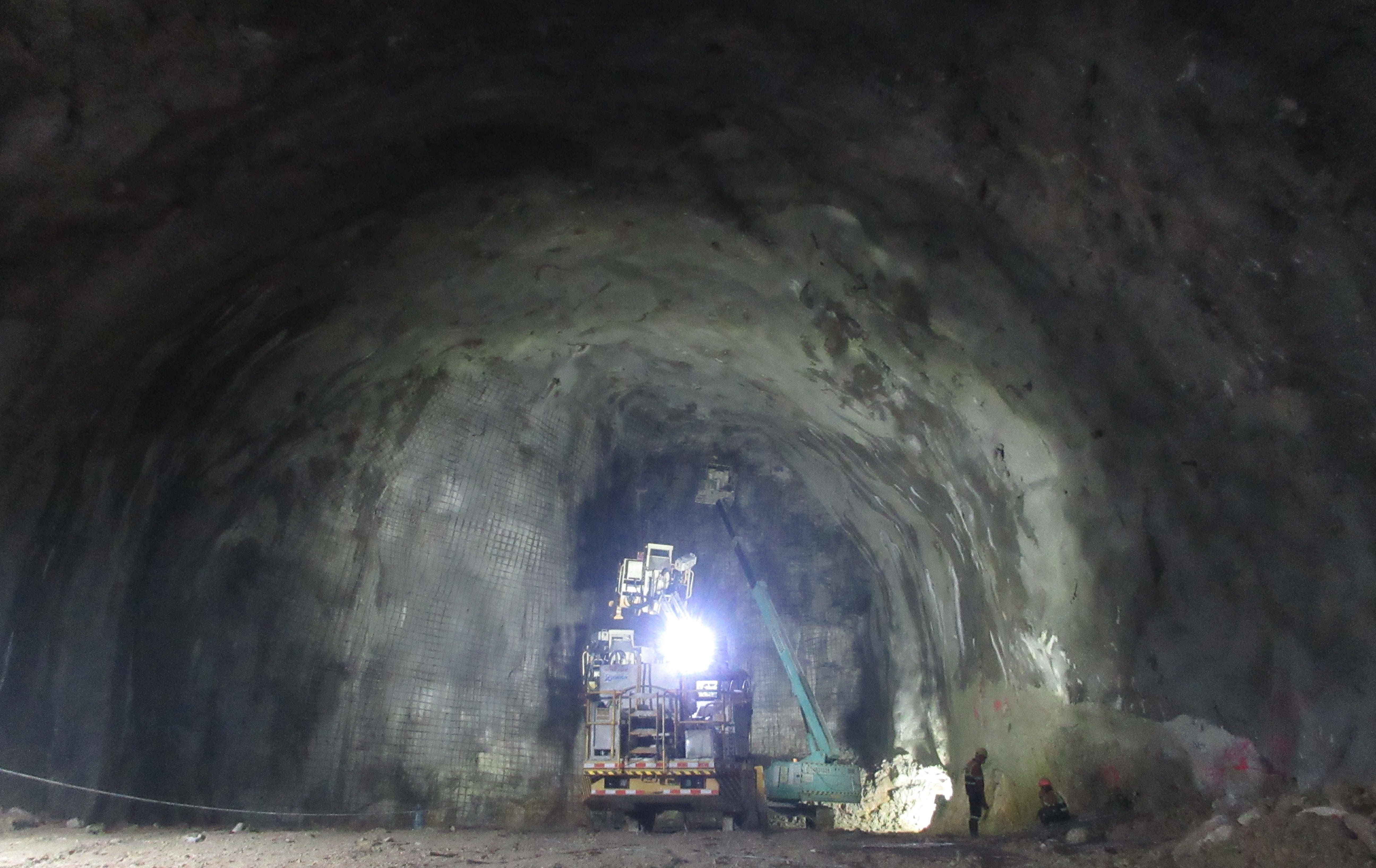
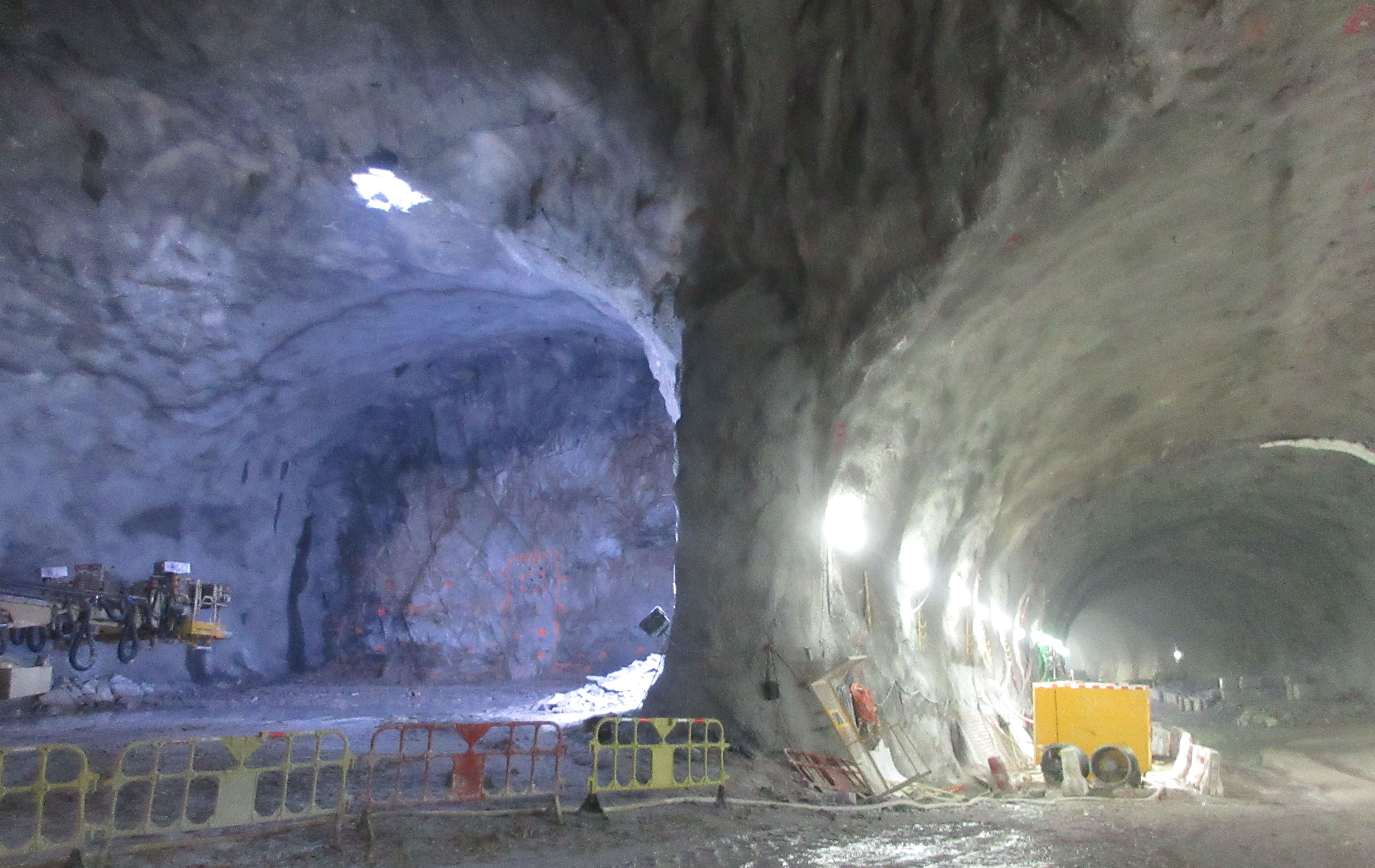
Contract 824 tunnels were formed using drill and blast techniques over a distance of approximately 3kms. The tunnel alignment runs deep beneath the natural terrain of Lam Tsuen Country Park between Ngau Tam Mei in the north and Tai Kong Po in the south. Permanent shafts were constructed at either end of Contact 824 for the Ngau Tam Mei Ventilation Building and the Tai Kong Po Emergency Access Point (EAP). A major cavern was formed approximately 100m deep beneath the mountainous terrain. Inclined boreholes up to 170m long were used to assist with ground conditions and Specialist GI testing during construction including permeability tests, wireline geophysics and acoustic tests. Extensive grouting was undertaken during shaft sinking to stem water flow during construction.
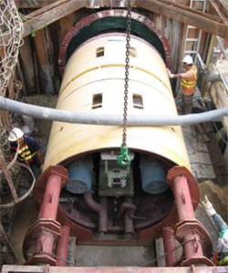
A single EPB shield was used to excavate the 2.3km long x 8.15m diameter parallel tunnels, with about 300m of the tunnels in rock or mixed ground. The works also included a 35m deep shaft and cross passages to link the twin running tunnels. Formation of the cross passages was locally problematic due to high ground water flows; comprehensive grouting and other techniques were required to complete the work.
The contract included a receiving pit for a tunnel beneath the adjacent highway and below the KCRC live rail in an area of existing high anchored walls.
The new drainage channel required two tunnel crossings immediately below the live KCRC (now MTRC) mainline rail that runs to the border at Lok Ma Chau. Design levels required minimum cover over the jacked concrete culvert with only about one metre between the top of the jacked culvert and the rail. The tunnelling was completed by a TBM. Real-time monitoring along the rail (as well as in the surrounding area) and jacking of the culvert was carried out 24hrs/day with appropriately tight Alert/Alarm/Action levels and restricted speed for passing trains.
Trunk Road T2 is a dual two-lane trunk road approximately 3.6kms long connecting Central Kowloon Route and the Tseung Kwan O – Lam Tin tunnel. Approximately 2 Kms of the 2.6km tunnel is immersed tube about 10 metres below the seabed. Two small temporary reclamation areas in the south east part of the site are required at the landfall areas.
Contract C1108 lies entirely on the northern part of the old Kai Tak Airport apron area immediately south of Kowloon City and separated from it by Prince Edward Road East. The construction contract includes: a new undergound station at Kai Tak; cut and cover; a mined tunnel between Kai Tak and Sung Wong Tai stations; entrusted works and an emergency egress point at Sung Wong Toi. KAT station box is approximately 290m long and the tunnel to the west approximately 660m long. The station and tunnel are located entirely within the area reclaimed for Kai Tak airport in an area reclaimed in 1924, with the remainder reclaimed in 1945. The construction was carried out primarily by a cut and cover method with temporary support and work was undertaken in stages to accommodate existing major infrastructure – Kai Tak Nullah, Lung Tsun Stone Bridge and Kai Tak City Pier.
Improved amenities for the general public is one of the benefits of the Shatin to Central link and in mid-levels this has included providing new over-head covered walkways, lifts and connections to the MTR stations. Tsz Wan Shan (near Diamond Hill) is within the mid-levels on Hong Kong island and can be problematic for piling due to the presence of difficult ground and ground water conditions. Significant difficulties were encountered during the works – requiring additional piling and grouting to complete the structures which were often located in zones of very tight access, between steep slopes and live roads. Monitoring included the impact on adjacent slopes and nearby buildings which were subject to some movement.
A major railway depot is constructed adjacent to the recently completed Shatin to Central Link at Pat Heung. Significant earthworks and major temporary excavations are required immediately next to the live rail. This requires the frequent submissions of detailed calculations and supporting documents.
The Tseung Kwan O to Lam Tin (TKO-LT) Tunnel scheme is a 4.2km dual two-lane highway connecting Tseung Kwan O in the East to Trunk Road T2 at Kai Tak. Contract NE/2015/01 is the construction contract for the main tunnel of the TKO-LT Tunnel, Lam Tin major highway Interchange, ventilation building and administration building at Kwun Tong. The old quarry in Lam Tin will be the site of the interchange. The bedrock is predominantly Mount Butler Granite of the Cretaceous Period at western end of the tunnel and Mount Davis Formation Volcanic Rocks at the eastern end. Four fault zones are shown along the tunnel, on the geological map. Two of them are located on the western side near Lam Tin, one is located in the middle of the tunnel and the fourth fault zone is located at the eastern side near Junk Bay. The tunnel blast material is removed from the tunnel to temporary stockpiles – where it is sorted and processed for removal from site, predominantly by barge.
The Tung Chung Road between Lung Tseng Tau and Cheung Sha is a dual-lane highway and the second stage of upgrading between Lung Tseng Tau at its northern end and Cheung Sha Beach to the south. The project provides a major highway link across the centre of Lantau and crosses through Lantau North, Lantau South and the proposed Lantau North (Extension) Country Parks. The road alignment is very steep terrain requiring frequent bridge crossings and embankments which were designed to limit the footprint of the new alignment on the adjoining country park and to minimise the impacts on ecologically sensitive streams. The highway construction cost was HK$627 Million. A consequence of the steep terrain was that in June 2008, after extraordinarily heavy rainfall, significant erosion and settlement damage occurred along the route, particularly in the southern section. The settlement was so significant and extensive that the road was closed. Subsequent investigations revealed the extent and cause of the damage.
Drainage
ONLYgeotechnics has completed two major projects with Drainage Services Department (DSD) related to the site role of Independent Geotechnical Engineer (IGE). Each project involves full-time site staff – requiring advisory and supervisory skills – with significant technical head office support. The IGE role is particular to DSD who frequently design their schemes in-house and supervise the works. Procurement rules dictate that geotechnical works shall be independently supervised by a professional geotechnical engineer. Each project has its own particular challenges.
The first of the two projects required the use of a TBM to tunnel beneath the KCRC railway (now MTRC) during its operation at extremely close distances to the live rails in shallow ground. The second project was a very high profile project both because of its location within Happy Valley Racecourse and because of the highly sensitive display equipment associated with the horse racing (this was fully monitored to avoid excessive movement during construction). There was extensive temporary works during construction and the second project became a showcase demonstrating the effectiveness of using NEC- contracts on major Hong Kong infrastructure projects.
ONLYgeotechnics provided full-time supervision with head office technical support over a period of several years for each project and was involved with ground investigations, monitoring, approvals, piling, tunnelling, monthly reporting and many other tasks.
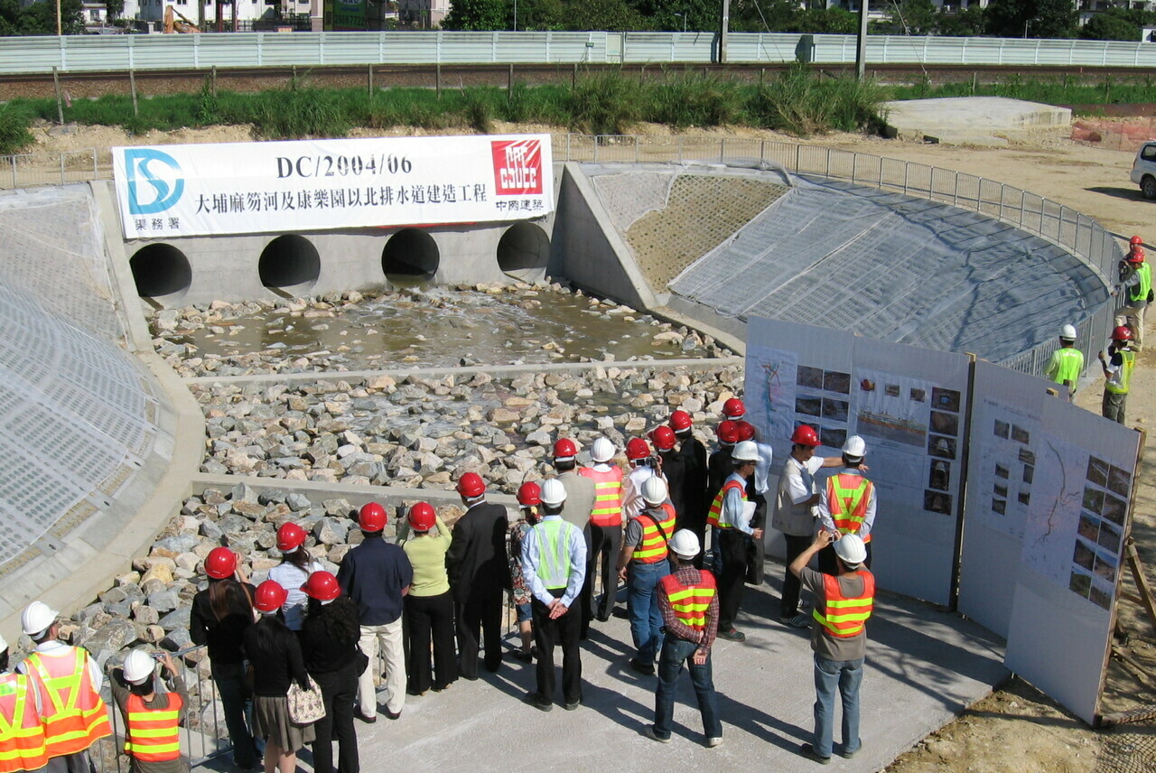
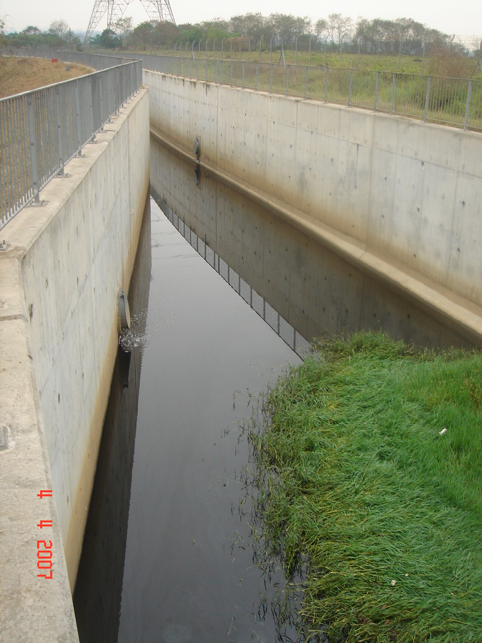
The Drainage Services Department designed and supervised the construction of a major drainage channel in the New Territories as part of a nationwide scheme to reduce flooding in villages and remote areas during heavy rain. Particular features of this project were the use of an inflatable dam for temporary storage of flood water (at times of heavy rain), the greening of the banks of the flood channel to encourage local fauna, flora and wildlife to redevelop and the provision of a TBM to tunnel beneath the live KCRC railway during its operation. There were several bridge crossings which were typically supported by mini-piling and other issues related to earthworks and stability.
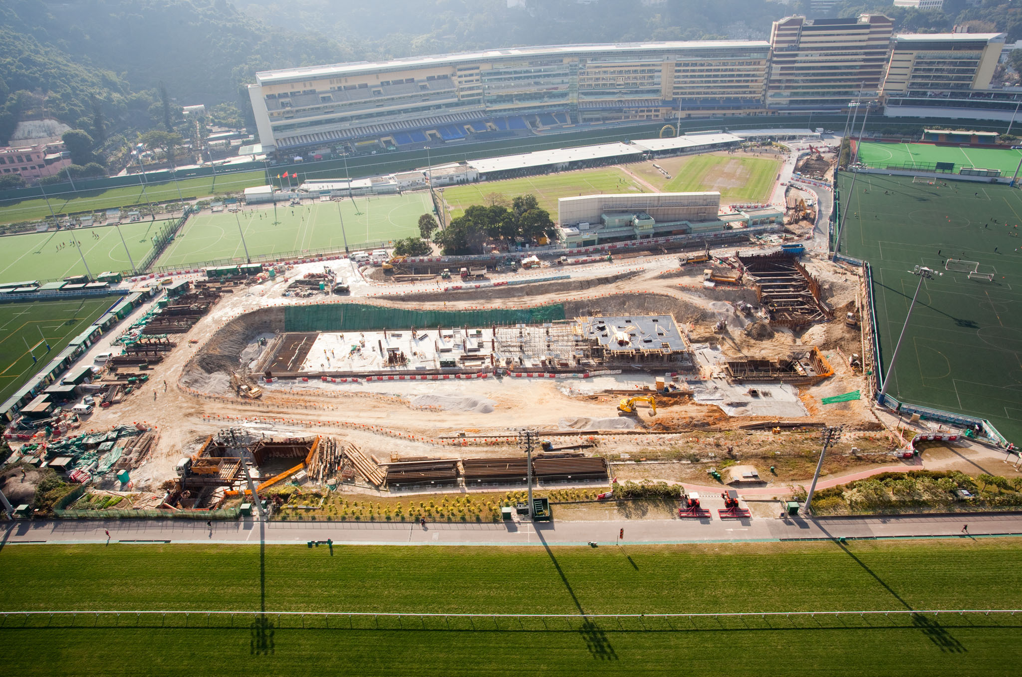
Happy Valley was first developed as a race-course in 1846 on a piece of ‘swampy land in a valley’ and was ‘often affected by floodwater.’ The area around Happy Valley has long been prone to flooding problems. During major rainstorms (in August 2000, April 2006 and June 2008) severe flooding occurred in Happy Valley and the adjacent areas (including Sing Woo Road, Wong Nai Chung Road, Morrison Hill Road, Lap Tak Lane, the Happy Valley Racecourse and the Recreation Ground). Since improvement of the drainage by open trench in such a heavily trafficked part of Hong Kong would be disruptive, an underground storage tank was proposed (to avoid serious disruption to the public and to minimize the complicated diversion of underground utilities).
The underground storage tank will temporarily store part of the stormwater collected from the upstream catchment. The addition of the storage tank would enable the drainage system to handle major rainstorm events effectively, thus minimizing flooding problems in the area. The stormwater will subsequently be discharged – via pumps and gravity drains – to the outfall once the stormwater flow volume in the existing drains has subsided.
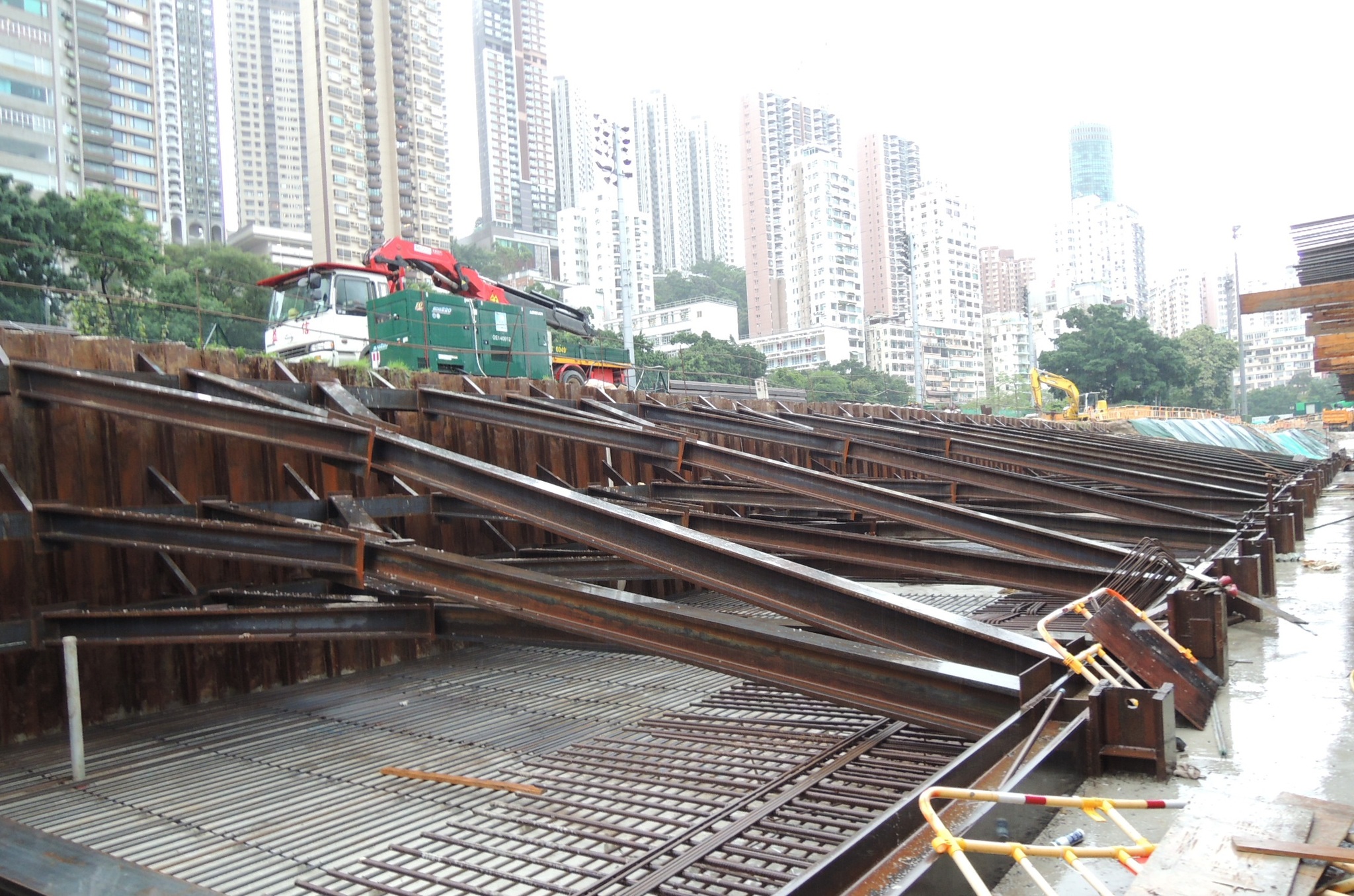
The Scheme was constructed under NEC contract conditions and was the first major NEC project in Hong Kong led by Drainage Services Department who designed and supervised the construction of a 60,000m3 underground storage tank, located below the existing football pitches at Happy Valley (within the famous Jockey Club horse racing circuit that surrounds the site). Logistics was one of the project challenges with all arisings taken off site. Temporary excavations supported by strutted sheet pile walls have been carried out in close proximity to sensitive structures. Soil-Structure Interaction modelling was conducted as a part of the design of temporary support for sheet pile walls. The project requires extensive geotechnical instrument monitoring with daily feedback to the relevant parties.
Building / Foundations
ONLYgeotechnics has worked on a variety of buildings and foundation projects. The projects are mostly related to settlement distress or piling leading to unexpected ground loss or the loss of support. The company has investigated ground loss and sink-holes, toe levels, causes of extensive cracking. These investigations have often required focused ground investigation and analysis.
The piled foundations for the extension to Olympian City II provides a floor area in excess of 1 million square feet of combined residential and commercial development. This major building development is at the junction of Hoi Wang Road and Hoi Ting Road in West Kowloon. The foundations are deep into bedrock through existing reclamation and include at least 100 bored piles (up to 3.3m diameter) and not less than 300 steel H-piles with pile lengths exceeding 60m. Temporary casings were installed to bedrock with investigations to resolve the reasons for significant casing loss.
The single storey factory is located in Yuen Long adjacent to Castle Peak Road near the Kam Tin river which is a major drainage channel in the area. The area is prone to flooding being ancient marshland with very soft ground near the surface and has been frequently covered by more recent fill (notably in the 1960s and later to provide industrial space). Major drainage works were in progress in the area as part of the upgrading of rural drainage and new flood control measures – Drainage Services Department. The work near the factory included construction of a 4m deep drainage channel along one side of the site, which was constructed in a sheet pile de-watered trench. The factory roads and buildings were not in top condition at the commencement of the work, with records of some cracking and settlement. Nonetheless further movement was reported following commencement of the ground works nearby which required detailed investigations and settlement analyses.
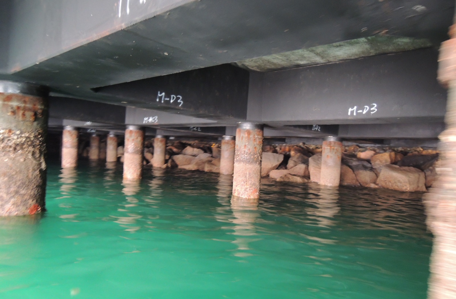
Terminal 6 is over 30 years old and is required to operate in highly aggressive environmental conditions, under heavy impact loading. Regular maintenance and monitoring are an essential part of managing the terminal. This involves restricted access beneath the decks to check for concrete spalling and other defects – ensuring the structure remains serviceable. In the event of sudden impact loads (due to collision), detailed assessments become of critical importance.
Olympian City II is a part of the major city complex comprising high-rise, shops, a cinema complex and other facilities. It is adjacent to the nearby Olympic Station. During construction of the cinema, a detailed investigation of the ceiling was carried out.
Harbour Grand, Hong Kong is surrounded by new development; the re-construction of the highway and greening area lie seawards (in front of the hotel) and major high-rise residential developments across the street. The nearby construction had some localized effects in the outside areas of the hotel which were investigated through reviews and monitoring.